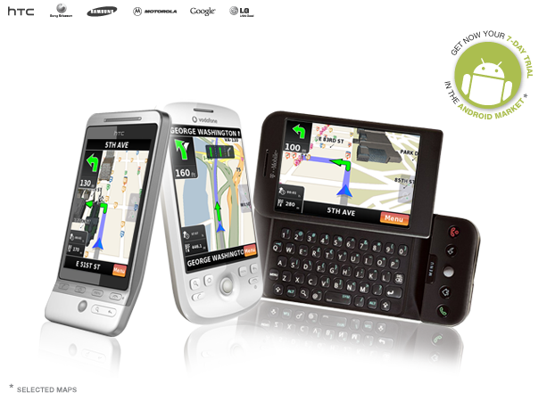
NDrive
 Map Display / Graphics
1. Dynamic adaptive drawing engine that can do 10 frames per second in a 400 MHz processor – providing a video-like experience.
2. Free rotation and tilt control on and off routing
3. Use of 3D objects render – Landmarks
4. No limitation on zoom in and out on and off routing
5. Display of pedestrian streets, ferries routes and trains
6. Display of terrain types (urban, green, river and sea)
7. Allows to choose from 6 design templates included, or import users’ made in XML
Interface
1. Use of gesture recognition with velocity
2. 100% finger or keyboard operated
Search
1. All searches have instantaneous feedback – results are displayed while typing.
2. Accepts search for city centre, street centre, street number, street crossings
3. Accepts search from postal codes system instead of city
4. Faster searches:
+ By the usage of initials or parts of initials in any order
+ Results are based on city population (large cities are displayed on the top).
+ Record of partial history of past searches
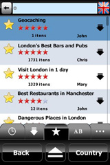
5. Accepts search by POI names in cities or POI by proximity
6. Accepts search by all POIs in a city or limited by POI category or sub-category
7. POI information can have: phone, email, URL and description in HTML, that are usable by the phone hardware
8. Accepts search by coordinates in 3 coordinates´ formats
9. Records all search history (deletable)
10. Accepts ABC or Qwerty keyboard layout, or even keyboard input from compatible hardware
Routing
1. F aster, shorter or pedestrian modes
2. Choose between “Accept Tolls” or “No Tolls” o n routing calculation
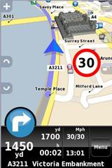
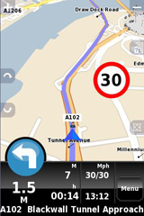
3. Information displayed : Next manoeuvre and its distance , total distance to destination, actual time, estimated time to arrival and arrival time
4. Demo routing, if GPS is disconnected
5. Road book available with past and next manoeuvres
6. Automatic routing recalculation on missed manoeuvre
7. Can display off-road routing till next available road
8. Show present street and next street name on approaching manoeuvre
9. In routing can: calculate alternative route, block road by distance or from road book
10. In routing can move, pan and ask the interface for street names or POI names simply by tapping on the screen.
11. In routing can search for another places and route directly without stop navigating.
12. Can route from map coordinates by screen input
13. Can route from received SMS with coordinate, POI or Favourite, on phone devices
Safety
1. Sound Alarm for specific absolute speed
2. Visual and Sound Alarm for street maximum allowed speed
3. Visual and Sound Alarm for safety radar proximity with velocity limits
4. Safety radar can be imported from KML open formats by the user
Favourites and communities
1. Can handle unlimited favourites’ categories defined by the user
2. Supports unlimited number of favourites
3. Favourite categories can be customized by user with: name, visible or invisible on map, visibility scale, displayed icon (from icon library or user generated icon)
4. Favourites can have: name, address, email, phone, web, fax, description and are fully interactive with phone hardware
5. Favourites can be exported and imported to KML format for sharing with friends and viewing in Google M ap(TM) and/or Google E arth(TM)
Settings / Customization
1. General: Sound volume, backlight, O n or P ower S afe mode, system time
2. Localization: Can handle 28 languages, keyboard preference and Km/Mph
3. Map appearance: Auto zoom on/off, Landmarks on/off, Templates, POI display settings by categories
4. GPS: ports, settings, coordinate type and GPS specific display with compass, coordinates, altitude and current speed
5. Battery charging status
6. Interactive HTML manual included
7. Software device licence via web registration, hardware data connection, SMS, or bulk licence modes
Upgrades and website services
1. Can use NDrive Agent for automatic software, map, radar, voices upgrades or purchases
2. Website support: Customer support by email, FAQ, video tutorials, manual downloads and accessories purchase.